Around Tampa Night Merged

Soulwalk Maps


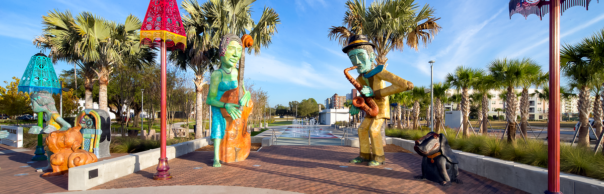
Central Avenue & The Scrub

Following the Civil War, a large portion of Tampa’s formerly enslaved Black population formed a new neighborhood just to the northeast of the city in an area of scrub palmetto. The community took on the name The Scrub, and by 1900 a business community began to take root along Central Avenue, which ran along its western border. Once the core of Tampa’s Black community, the business district is now home to Perry Harvey, Sr. Park and The Scrub is the site of the ENCORE! development.

Map highlighting Central Ave with photos of local sites along "The Scrub" trail.

Path 1

Distance: Approx. 0.5-0.74 miles

Map highlighting Central Ave path around Oaklawn Cemetery.

Path 2

Distance: Approx. 1 mile

Map showing a route along N. Central Ave with key points marked.

Path 3

Distance: Approx. 0.9 mile

Pathway map through Central area, showing route from Railroad Station to Saunders Library.
ID Landmark Name Landmark Type Address
30 St. Paul AME Church Church 506 E Harrison St.
31 Historic Harlem Academy School 502 E Harrison St.
32 Oaklawn Cemetery Cemetery 606 E Harrison St.
33 Greater Bethel Baptist Historical Marker 805 E Laurel St.
34 Ray Charles First Recording Historical Marker 813 Short Emory St.
35 Kid Mason Community Center Community Center 1101 N Jefferson St.
36 Int'l Longshoreman Association Local #1402 Hall, est. 1935 Historical Marker 707 E Harrison St.
37 Historic Central Avenue Mural Art Installation 1101 N Jefferson St.
38 Central Avenue Historical Marker Historical Marker 1000 E Harrison St.
39 Perry Harvey, Sr. Park Art Installation 1000 E Harrison St.
40 Perry Harvey, Sr. Park Art Installation 1000 E Harrison St.
41 Perry Harvey, Sr. Park Art Installation 1000 E Harrison St.
42 Tampa's Black History Museum Museum 1213 North Central Avenue
43 Perry Harvey, Sr. Park Art Installation 1000 E Harrison St.
44 Perry Harvey, Sr. Park Art Installation 1000 E Harrison St.
45 Trio Art Installation 1101 Ray Charles Blvd
46 Meacham Urban Farm Urban Farm 1108 E Scott St.
47 Paradise Missionary Baptist Church Church 1112 E Scott St.
48 St. Peter Claver School Historical Marker 1401 N Governor St.
49 Ebenezer Missionary Baptist Church Church 1212 E Scott St.
50 Two Wood-Frame Homes Historic House 1248 and 1250 E Scott Street
51 Central Park Village Site Historic Village Bounded by Kay St. (N), Cass St. (S), Nebraska Ave. (E) & Orange Ave. (W)
52 Procession Garden E Harrison St.
53 St. Peter Claver Catholic Church Church 1203 N Nebraska Ave.
54 Greater Mt. Moriah Primitive Baptist Church Church 1225 N Nebraska Ave.
55 Robert W. Sanders Public Library Library 1505 N Nebraska Ave.
56 Greater New Salem Primitive Baptist Church Historical Marker 1605 N Nebraska Ave.
57 Booker T. Washington Historical Marker 1407 E Estelle St.

Downtown

Downtown Tampa is the oldest part of modern Tampa, dating back to the creation of Fort Brooke in 1824. The Village of Tampa grew up just north of the fort, and by 1855, that village became a city. As a southern city, a portion of the population consisted of enslaved Black people. Following the Civil War and into the late 1800s, the northern end of Tampa, from Polk Street north, saw a concentration of African American residents and businesses.

Maps & Landmarks

Downtown Soulwalk map with a marked route and photo highlights of sites.

Path 1

Distance: approx. 1.4 miles

Downtown walking path map near Tampa Convention Center with directional arrows.

Path 2

Distance: Approx. 1 mile

Map of a downtown walking path near Curtis Hixon Waterfront Park by Hillsborough River.
ID Landmark Name Landmark Type Address
1 Union Station Historical Marker 601 N Nebraska Ave.
2 Jackson House Historic House 851 E Zack St.
3 Judge George E. Edgecomb Historic Statue Edgecomb Courthouse
4 Bronze Medallions on Zack Street Art Installation Zack St & Florida Ave.
5 Former F.W. Woolworth Store Historical Marker 300 E Polk St.
6 Cast Glass Trellis Art Installation Zack St & Ashley Dr.
7 Jimi Hendrix Historical Marker N Ashley Dr and E Zack St.
8 Tampa Museum of Art Museum 120 W Gasparilla Plaza
9 Lynching Marker Historical Marker Downtown
10 Garfield Devoe Rogers Bust Historic Statue Historical Monument Trail RW
11 Benjamin Elijah Mays Bust* Historic Statue Historical Monument Trail RW
12 Henry B. Plant Museum Museum 401 W Kennedy Blvd
13 Fearless Four, Tampa PD Historic Monument 411 N Franklin St.
14 Evidence Art Installation 411 N Franklin St.
15 Moses White Bust Historic Statue Historical Monument Trail RW
16 Lee Roy Selmon Statue Historic Statue S Florida Ave and E Brorein St
17 Cyril Blythe Andrews Bust* Historic Statue Historical Monument Trail RW
18 Edward Daniel Davis Bust* Historic Statue Historical Monument Trail RW
19 Francisco Aristides Rodriguez, Jr. Bust* Historic Statue Historical Monument Trail RW
20 Tampa Bay History Center Museum 801 Water St.
21 Paulina Pedroso Bust* Historic Statue Historical Monument Trail RW
22 TECO - HSBD Station (#9) Streetcar Stop 670 Water Street
23 Cody Fowler Bust Historical Marker Historical Monument Trail RW
24 Fortune Taylor Bridge Historical Marker Laurel St. & Hillsborough River
25 Straz @ Riverwalk (Electrical Box wraparound) Performing Arts Center W Cass St and W Gasparilla Plz.
26 Doyle Carlton Section of RW Art Installation Fortune Taylor Bridge RW

*All Bronze Busts along Riverwalk are by Artist Steve Dickey


The Garrison

The Garrison, as a neighborhood, grew from the closing of Fort Brooke by the War Department in 1883. Shortly after the closure, the property was transferred to the Department of the Interior and opened up for homesteads. Four families, three of whom were African American, filed for homesteads. Those three families eventually took possession of the eastern and northeastern sections of the old fort. The area was soon surrounded by the new Port of Tampa, and Black dock workers and their families began to move into the growing neighborhood.

Maps & Landmarks

ID Landmark Name Landmark Type Address
27 Neon - "You Belong Here" Art Installation 615 Channelside Dr.
28 TECO - Publix Station #5 Streetcar Stop 1113 Channelside Dr.
29 TECO - Cumberland Avenue Station #7 Streetcar Stop 828 Channelside Dr.
Garrison area map with streets highlighted in pink, compass at bottom right.

Updated: 12/04/2025